Water
Background
Water is a necessity for human and nature, which, however, is highly unevenly distributed spatially and temporally in a manner that easily leads to conflicts and crisis. Due to the fluidity of water over international borders, geopolitical tensions arise between nations that share international rivers about cross-border water ownership, allocation, utilization, protection, compensation, etc. Moreover, as industrialization and climate change intensify, the disparity between water supply and demand becomes more pronounced. Transboundary water or international rivers inevitably result in interstate negotiations and geopolitical confrontations surrounding issues such as water allocation and large-scale water infrastructure construction.

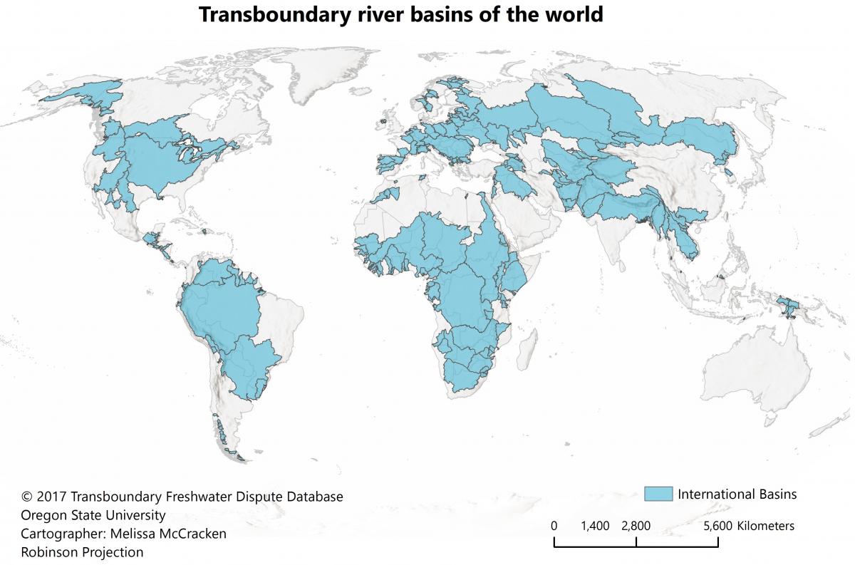
Over 150 countries in the world share more than 310 international water basins, which provide freshwater for more than 3 billion people (McCracken and Wolf 2019). Occupying the Asian Water Tower, China shares rivers with 18 neighboring countries. Taking cases of the Lancang-Mekong River and Dongjiang River, I examine the complex institutions, discourses, imagenaries, and power relations of international/inter-jurisdictional river governance through a set of concepts including hydrosocial territories and scalar politics.
Hydrosocial territories of transboundary rivers
Wang, R. Y., Liu, X.*, Zhang, W. China’s water governmentality and the shaping of hydrosocial territories: A case of the Lancang–Mekong cooperation mechanism. The China Quarterly (OnlineFirst) Link
Taking the case of Lancang-Mekong Cooperation (LMC), this paper demonstrates the diversity of power and the complexity of space of international rivers. It reveals the multidimensional characteristics of nature, system, history, and culture in the Lancang-Mekong region. This research discusses how discourses and geographical imagination are formed and legitimized as a political weapon in the cooperation mechanism to construct the international rivers’ hydrosocial territory. In addition, the research highlights the competitiveness of discourses and the diversity of geographical imagination in the transnational context, thereby introducing regional disputes. This enhances the knowledge of power exercise in international river governance and illuminate the multiple ontologies of water and space.
Wang, R. Y., Zhang, W., Liu, X.. 2022. The geopolitical analysis of international river governance: A conceptual framework of “hydrosocial territories”. Human Geography(人文地理),(02), 41-49+102. Link
This work reviews the theoretical discussions and controversies of international river governance and introduces the conceptual framework of“hydrosocial territories”. The paper summarizes that the framework reveals spatial deployment of power and explores the natural-society relationship from four previously underexamined analytical dimensions.
- Power exercises apply at multiple scales and involve interconnections and interdependence across scales.
- The deployment of power exists in physical, institutional, and representational spaces that jointly shape rules, narratives, and meanings of water.
- The essence of water governance is defined by relationship networks that include and exclude different actors.
- Hydrosocial territories are fluid, constructed, and contested, encapsulating diverse forms of power exercises.
Liu, X., Souter, N. J., Wang, R. Y., & Vollmer, D. 2019. Aligning the Freshwater Health Index indicator system against the transboundary water governance framework of Southeast Asia’s Sesan, Srepok, and Sekong river basin. Water, 11(11), 2307. Link
Water resource management operates within a governance framework, which comprises international conventions and agreements; national and provincial laws, policies, guidelines and plans; and informal traditional arrangements. Indices may fit within a water governance framework in a variety of ways. This paper takes Conservation International’s Freshwater Health Index system to examine its alignment with laws, plans, and policies of 3S countries along the transboundary Sesan, Srepok, and Sekong (3S) rivers in the Lower Mekong in Southeast Asia.
Scalar politics of inter-jurisdictional rivers
Liu, X., Wang, R. Y., Zhang, W., Ge, Y. 2021. Rescaling inter-jurisdictional water governance: A case study of the Dongjiang river. World Regional Studies(世界地理研究), 30(02), 297-307. Link
This paper explores scalar reconstructions of Dongjiang river governance in material space, organizational space, and discursive space over the course of policy formulation and implementation. The evolution of Dongjiang river governance experienced three major stages, infrastructural development for Hong Kong unification, water allocation for uneven regional development, and ecological compensation for upstream-downstream inequality.
The focal scale of water governance in the Dongjiang River has shifted and co-existed between the political and ecological scales. Various actors at national and local scales are trying to construct their own discourses over the water issues and achieve certain scalar reorganization to facilitate their goals. Over the course, while the central government dominates formulation and implementation of water governance policies in the Dongjiang River basin, sub-national governments, public groups and other relevant organizations are also engaged in the competition of scalar construction.
References
[1] McCracken M and Wolf A T. 2019. Updating the Register of International River Basins of the world. International Journal of Water Resources Development, 35(5): 732-777.